Mine Geometry Models
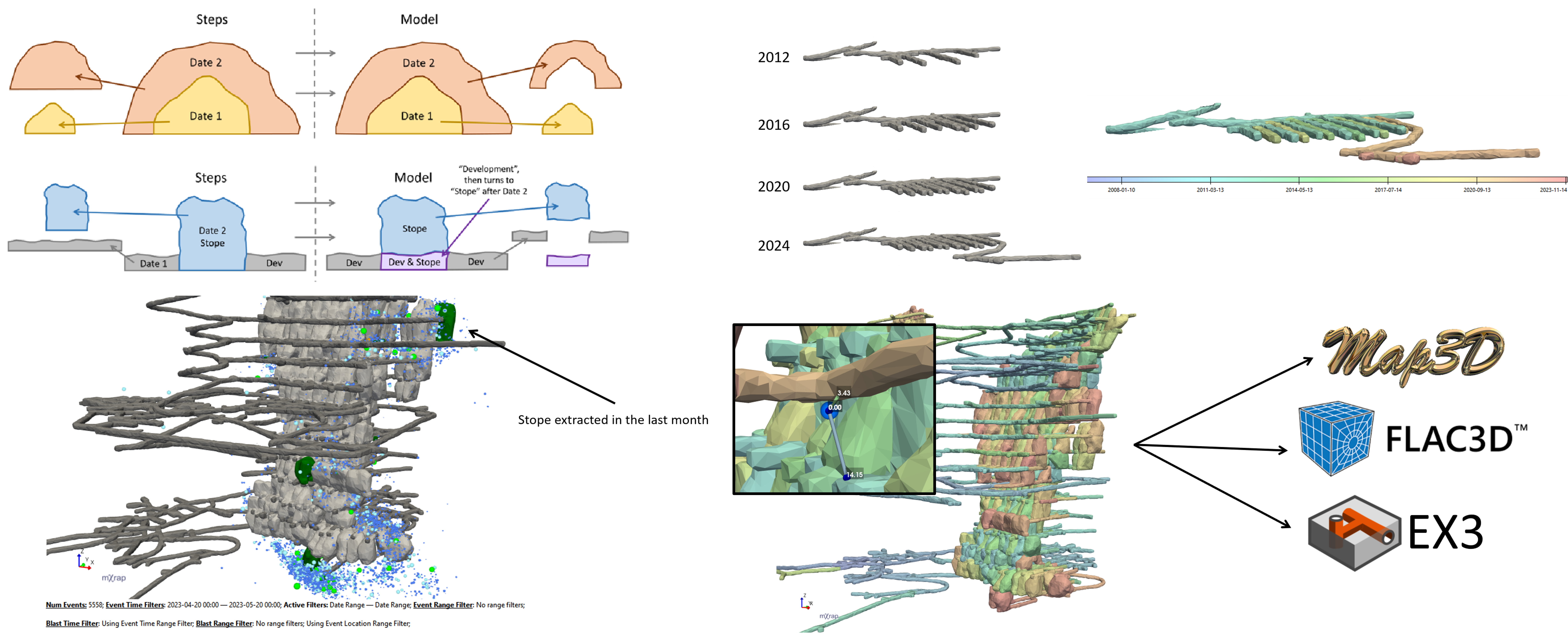
Mine Geometry Models is an utility app for creating volumetric models of mine geometry that include the changes in geometry over time. Stope, cave and development geometry is a fundamental aspect of most geotechnical analysis. Capturing variation over time is critical in any back-analysis or numerical modelling or monitoring data over time. The generated models can be used in many other mXrap apps, and can also be exported for use in other software.
Key Features
- Determine volumes from closed surveys, and assign attributes to create steps (e.g. mining date, type of geometry, material)
- Discretise into a regular grid of cubic cells the specified volume
- Dectection by the algorithm of which cells are inside and outside excavations, and which cells are being cut by the boundaries of excavations.
- Combine multiple steps to create a model, automatically resolving the change in geometry between steps.
Within other mXrap apps
- Live surveys
- Use a model in General Analysis and other apps to see geometry that automatically updates with your current time filters, so when you do back-analysis you see only the geometry that was present at the time
- Calculate mining volume over time, plot seismicity and other parameters as a function of mine geometry
- Use steps as volumetric filters in other mXrap apps, e.g. to filter events within a certain lithology volume
- Calculate distance : Between large events or damage location to the nearest development or stope at the relevant time.
- Generate minodes for use in Hazard Assessment and other mXrap apps
In other software
- Export models ready to use as numerical modelling input directly in numerical modelling software such as Map3D and FLAC3D, or as cleaned DXFs ready for use in various other software packages
- Map3D .inp files and FLAC3D grid files can be generated directly, allowing for mine-scale models to be built and ported to numerical modelling packages in a matter of minutes.
Supported Data Types
- Surveys: All survey formats supported by mXrap’s core survey tools (dxf, vdcl, dtm). Surveys with attributes can be used to more efficiently generate models (e.g. stope surveys that have a firing date attribute)